FS Road 129. Going about .5 miles on this road until you intersect the Devil's Rest trail. Leaving the bikes, we walked on the trail. The Green Trails map "Columbia River Gorge West" is useful.
 |
| Soon reaching a viewpoint |
Continuing West on the trail and wearing hunter orange because it is still deer season.
We reach Devil's Rest which is a pile of big rocks now overgrown with trees (you can't see a view from here)
We walk back to where we left our bikes (did not see anyone else on the trail today) This sign marks where FS Road 129 intersects with the trail. Trail is mostly flat in this area. We got back on the bikes and rode back to FS Road 1520, continuing downhill. The anonymous hiking partner's idea was that we could coast downhill to the bottom of this road which ends where Brower Road goes over Bridal Veil Creek.
 |
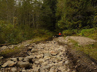
| We soon encountered some washed out areas |
But the man said he wasn't going to ride uphill. (the entire plan was made to avoid walking or riding uphill)
Fortunately, we were soon back to real road as the creek dropped farther below the road bed.
And quickly reached the bottom of the road.
Bridal Veil Creek near road's end.
On the way home, we saw this Pileated Woodpecker (Dryocopus pileatus) excavating a dead tree.


No comments:
Post a Comment