Friday, October 28, 2011

Devil's Rest - (and all the details) 10/28/11

The last of the "25 hikes" was actually a hybrid journey designed by my anonymous hiking partner.  We set up a car shuttle and started with mountain bikes at Forest Service Road 1520 which is at about mile post 10 on Larch Mt. Road.  To reach Larch Mt. Road go East on I-84 to Exit 22 (Corbett).  Go up the hill and turn left (East) on the Columbia River Scenic Highway. Go about 2.5 miles and turn left on Larch Mt. Road.  FS Road 1520 is gated.  We got on the bikes and rode about 2 miles to


FS Road 129.  Going about .5 miles on this road until you intersect the Devil's Rest trail.  Leaving the bikes, we walked on the trail.  The Green Trails map "Columbia River Gorge West" is useful.
Soon reaching a viewpoint

Continuing West on the trail and wearing hunter orange because it is still deer season.


We reach Devil's Rest which is a pile of big rocks now overgrown with trees (you can't see a view from here)

We walk back to where we left our bikes (did not see anyone else on the trail today)  This sign marks where FS Road 129 intersects with the trail.  Trail is mostly flat in this area.  We got back on the bikes and rode back to FS Road 1520, continuing downhill.  The anonymous hiking partner's idea was that we could coast downhill to the bottom of this road which ends where Brower Road goes over Bridal Veil Creek.
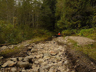
We soon encountered some washed out areas

But the man said he wasn't going to ride uphill.  (the entire plan was made to avoid walking or riding uphill)


Fortunately, we were soon back to real road as the creek dropped farther below the road bed.


And quickly reached the bottom of the road.


Bridal Veil Creek near road's end.


On the way home, we saw this Pileated Woodpecker (Dryocopus pileatus) excavating a dead tree.

Wednesday, October 26, 2011

Condit Dam Goes Down!

 It was a historic day in the Columbia River Gorge and law enforcement was ready for it.  A large hole was going to be blown in the base of Condit Dam in Washington at approximately 12 noon. The dam is located on the White Salmon River 3.3 miles upstream from the Columbia River and is North (and slightly West) of Hood River, Oregon.  See dam info on link below:
http://www.pacificorp.com/es/hydro/hl/condit.html#

Mt. Hood watches over the event

 A crowd gathered near the mouth of the White Salmon.  The road next to the river going up to the dam was closed.  The dam was finished in 1913 and blocks salmon and steelhead from traveling upstream (there is no fish ladder).  After scheduling the dam removal this fall, some salmon were transported above the dam this month. 
 A few people perched on rocks overlooking the canyon.
 Helicopters were monitoring the no-fly zone which had been established over the dam and lower river.
 The bridge over the White Salmon on SR14 was closed just before noon.  The hole was blown several minutes later (we did not hear the blast).
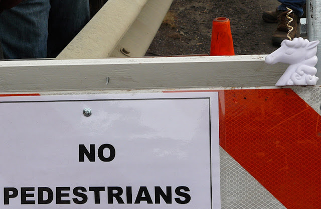
No barrier can stop a unicorn

This is the view we had of the mouth of the White Salmon River

 We had heard by radio that the water was rushing down the canyon but by the time it reached us

It was a small surge that spilled up over part of a dock
 And up into a bay that was bare moments earlier - the water took about 15 minutes to get here.


 Then sediment and debris began to arrive.  Large logs were carried downstream.

 As we walked back to the car, we saw some of the logs floating downstream in the Columbia.


For exciting video of the dam breaching - click on the arrow below!


Wednesday, October 19, 2011

Dog Mountain 10/19/11

 The trailhead is located off SR-14
in Washington, 12.5 miles West of the Bridge of the Gods (Cascade Locks).  A NW Forest Pass is required for parking.  There is a bathroom a short distance up the trail.  This trail presents the challenge of 2828 vertical feet in 3.8 miles, lots of Poison Oak, and the possibility of strong winds at the top of the mountain.  (The Forest Service should be paying you to go to the top - maybe we could work this into the national health care)
After about a mile of switchbacks you get to this split in the trail

We went to the right because it is "less difficult"

Soon you reach a forest carpeted with Oregon Grape - Mr. Thornsby approves
The trail opens out onto this viewpoint

 Looking downstream

 The wind was picking up speed here - notice the ears and tail!
 Come back in May or June to see the Balsamroot in bloom.  From here, the trail goes back into forest, then out onto the grassy mountain top for the last 3/4 mile.  Clouds and high winds dominated this last part of the trail today - not a pleasant hike.
The "view" from the top, looking down at the river

We only stayed at the top long enough to take a couple of pictures, then retreated down slope into the forest, away from the wind for a quick lunch, then headed home.

Thursday, October 13, 2011

Triple Falls 10/12/11

The hike to Triple Falls starts at the Oneonta Trailhead, about 5 miles East of Bridal Veil on the Historic Columbia River Highway.  There is a parking area on the North side of the road just before the Oneonta Gorge.


Trail switchbacks up the steep hillside until you are far above Oneonta Creek.  


The sun came out


Always a good thing in October.


Arrow shows us the way to the falls.  This trail is rather rocky, study shoes or hiking boot are needed.


Triple Falls - aptly named, from the viewpoint.
I don't think you can get down to the bottom


The view upstream of the falls from the bridge.
Looking towards the falls from the bridge


The trail goes on.


Monday, October 10, 2011

Coyote Wall and Indian Point Trails 10/9/11


This is not the parking area but an old cattle corral
 As the deadline for completing the 25 trails approaches, we started early on Sunday and drove East on I-84, crossing over to Washington (at either Cascade Locks or Hood River) and proceeding East on SR-14.  A few miles past Bingen, but before you get to Lyle, turn left on Courtney Road and into the parking area you will see immediately.  Cross Courtney Road and walk a short distance on a gated road to trailhead.
This sign marks a trail head - there is more than one trail starting from the old road

Looming above you is Coyote Wall, layers of basalt from old lava flows

Poison Oak is VERY plentiful along the trail - avoid it!

 Another view of the wall, which slopes down to the Columbia River.  The trail winds up through Oregon White Oak and then Ponderosa Pine.


 The trail is very popular with mountain bikers, but too steep for my biking pleasure.  I could easily imagine myself huffing and puffing as I push my bike up or losing control going downhill and crashing into a large patch of Poison Oak. 
 There is a tiny stream near the trail.  The trail continues upwards, I did not go all way the to the top - perhaps another day.

 We found this bracket fungus on an old oak stump - Mr. Thornsby says they are not edible.


After a quick lunch in White Salmon, WA (see previous photos of Everybody's Brewpub) we crossed the River back to Oreogn proceeded West on I-84 to Cascade Locks (exit 44) went under the freeway and on the frontage road to the Herman Creek Campground where you will find the trailhead.

Here's my anonymous hiking partner heading up the Herman Creek Trail (#406).  Now we are back in the Douglas Fir forest, much more green and shady than Coyote Wall.

After a short distance, you cross the powerline right of way, which helps you to find yourself on a map.


And allows me and Mr. Thornsby to pose behind a large rock (basalt).


Continuing on the Herman Creek Trail, you go back into the forest which has some weird looking trees and lots of moss (North facing slope).  There are a lot of piles of basalt in this section - covered with moss and forming little grottoes possibly inhabited by gnomes. (see below)

After 1.2 miles, If you want to continue towards Indian Point, you get onto the Gorton Creek Trail.


Which I did do, seeing lots of Oregon Grape in fruit
Mahonia nervosa has tart berries that are edible, but not choice.  Some people make jelly from them.  The plant was used medicinally by native people.  The inner bark of the stems and roots contains a powerful alkaloid called berberine and makes a bright yellow dye.

A view from the Gorton Creek Trail on this rainy day
I didn't go much farther, but if you want to go to Indian Point you proceed a few miles to the Nick Eaton Trail, then to the viewpoint, then you can return by the Herman Creek Trail.