Tuesday, May 24, 2011

High Water and Dry Creek Falls on May 18


 The lower Columbia River is as high as it has been since the '96 floods as can be seen here at the Sandy River Delta.  This is usually a dry meadow, now a slough connected to the Columbia.  The Confluence Project installation can only be reached by boat now.  (As I post this a week later, conditions are unchanged)


 Nice view of Mt Hood - usually this is dry land.

We proceeded on to Cascade Locks - had a burger at the Pacific Crest Pub

 Cascade Locks is exit 44 on I-84 East and is the home of the Sternwheeler,
among other things.www.cascadelocks.net/
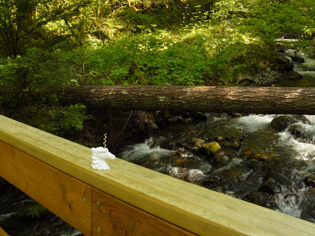
The new bridge over Dry Creek as seen by Mr. Thornsby


 Hike up to Dry Creek Falls on the Pacific Crest Trail from Cascade Locks (trailhead near bridge).  You can also drive up the undeveloped road to the Falls, but only if you have 4 wheel drive and high clearance - a bit too narrow for the school bus, I think.

Mr. Thornsby meets a Giant Stonefly


 This old water diversion was the source of the name, Dry Creek, I think, because when the water was diverted in the past, the creek became dry.  Today it is no longer functional.  The creek looks much better with water in it.


 Dry Creek Falls

Mr. T with Streamside Violets

Stop!  Don't drive into the river! (Dalton Point)

Tuesday, May 17, 2011

Elowah Falls and a Tiger

A Tiger Salamander that is, under my barn door in Corbett
To get to Elowah Falls -
 Drive East on I-84 to exit 35.  Turn left after you exit, stay on the frontage road for about 2.5 miles, until you see the sign for John B Yeon State Park, pull into small parking lot. Go up the trail a short distance, when you see this sign, turn left to go to Elowah Falls.  John B. Yeon made money cutting trees back in the day and built the Yeon Building in downtown Portland.  He was famous for being the Roadmaster of the Columbia River Scenic Highway, a job he did for almost no pay for 5 years.  In 1935, several years after his death, the park was dedicated to him.


 Star-flowered False Solomon's Seal is blooming now - it loves shady places in the forest, as do the ferns below.  Will the real Solomon's Seal please stand up?

 A rare sight below - the Calypso Orchid


Scouler's valerian was all along the trail.


 The lower falls - high flow today.
The bridge was quite slippery with all the spray

I got soaked here
McCord Creek from the base of the falls

Large pizza at the Pacific Crest Pub in Cascade Locks

Friday, May 13, 2011

Latourell Falls

A few miles East of Corbett, Oregon on the Scenic Highway
 Latourell Falls, like several other state parks in the Gorge, was donated to the state of Oregon by a wealthy landowner, AKA "robber baron".  Thank you, Mr. Talbot.  What was "The Birthday Club"?  Latourell Falls is my "most often hiked" in the Gorge because it is close to home, about 2 miles in a loop, beautiful, and mostly because most visitors only walk about 50 feet from the parking lot, take a picture and leave the trail uncrowded even on a hot summer weekend.  We went today, because we may never have a hot summer weekend this year.
 (it did rain this afternoon)


 Margaret Henderson opened the Falls Chalet in 1914, one of many roadhouses found along the Scenic Highway in the past.  Most, including this one, are long gone.

Mr. Thornsby in front of the Falls, with Fringecup and Bleeding Heart - native wildflowers

Fairy Bells hanging over Maidenhair Fern


 There are some big trees along the trail here - Arrow poses for scale by a  Douglas Fir.


The trail goes right next to the upper Falls.


It's always good to hang out at the bottom of a waterfall.
This trail is always cool and shady as it goes through a narrow canyon made by the creek.  You can see that moss is happy here.  In the winter the trail can be muddy and slippery.

A small diurnal moth, Rheumaptera subhastata, sat on the trail


 Western Baneberry - the name tells you that the    berries are toxic.


Another poisonous beauty - Larkspur - is finally blooming here

Latourell Falls again

A bonus - on the way home, a Turkey Vulture contemplates a dead mole in the road.

Tuesday, May 3, 2011

Memaloose Hills, Oregon


Since it was still April and cool, we didn't see any rattlesnakes
Despite the warnings we decided to hike here on April 30.  This trail is not marked and directions are vague, but that should never stop you!  Drive East on I-84 to the Memaloose Rest Area.  Then walk uphill. 

The hike starts out in a shady forest

 Is this "ecoroof" intentional or by neglect? This outbuilding was near a water tower.
 Here is Oregon Grape (on the right) and the promised Poison Oak (reddish leaves on the left).  The plant usually appears green and turns red in the fall, but everything we saw was reddish-brown today. Leaves of three - let them be!  An oil on the surface of the leaves and stems can produce a delayed hypersensitivity reaction in some people (myself included).  The itching and irritation can last for weeks and may require medical attention.   Poison Oak is common in the Eastern Gorge, especially near oak trees, and on sunny slopes.  It is a native plant.
There are nice views here despite the dangers

And lots of basalt
Here is one of our native Larkspurs
Memaloose Island, known as Memaloose Ilahee in Chinook, "land of the dead".  It was a Native American burial ground, and the above-ground burial structures and bones were still visible in the early 20th century.

 When you get to the top of the bluff, you find this sign at Memaloose Overlook on the Scenic Hwy.


Lots of Balsamroot and Paintbrush on the way up

Perhaps a favorite food of rattlesnakes, ground squirrels are active at the rest stop